


Voting District ML, Hertford County, North Carolina
About
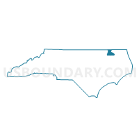
Outline

Summary
| Unique Area Identifier | 640479 |
| Name | Voting District ML |
| County | Hertford County |
| State | North Carolina |
| Area (square miles) | 18.36 |
| Land Area (square miles) | 18.36 |
| Water Area (square miles) | 0.00 |
| % of Land Area | 100.00 |
| % of Water Area | 0.00 |
| Latitude of the Internal Point | 36.25819120 |
| Longtitude of the Internal Point | -77.12943200 |
Maps


Graphs
Select a template below for downloading or customizing gragh for Voting District ML, Hertford County, North Carolina


Neighbors
Neighoring Voting District (by Name) Neighboring Voting District on the Map
- Voting District A2, Hertford County, NC
- Voting District M1, Bertie County, NC
- Voting District M2, Bertie County, NC
- Voting District RICH S, Northampton County, NC
- Voting District RX, Bertie County, NC
- Voting District SJ, Hertford County, NC
Top 10 Neighboring County Subdivision (by Population) Neighboring County Subdivision on the Map
- Ahoskie township, Hertford County, NC (8,620)
- Rich Square township, Northampton County, NC (3,214)
- St. Johns township, Hertford County, NC (2,822)
- Mitchell township, Bertie County, NC (2,628)
- Roxobel township, Bertie County, NC (1,671)
Top 10 Neighboring Unified School District (by Population) Neighboring Unified School District on the Map
- Hertford County Schools, NC (24,669)
- Northampton County Schools, NC (22,099)
- Bertie County Schools, NC (21,282)
Top 10 Neighboring State Legislative District Lower Chamber (by Population) Neighboring State Legislative District Lower Chamber on the Map
Top 10 Neighboring State Legislative District Upper Chamber (by Population) Neighboring State Legislative District Upper Chamber on the Map
Top 10 Neighboring 111th Congressional District (by Population) Neighboring 111th Congressional District on the Map
Top 10 Neighboring Census Tract (by Population) Neighboring Census Tract on the Map
- Census Tract 9202, Northampton County, NC (4,636)
- Census Tract 9602, Bertie County, NC (3,953)
- Census Tract 9603, Bertie County, NC (3,667)
- Census Tract 9504.01, Hertford County, NC (3,543)
- Census Tract 9503, Hertford County, NC (3,303)
Top 10 Neighboring 5-Digit ZIP Code Tabulation Area (by Population) Neighboring 5-Digit ZIP Code Tabulation Area on the Map
- 27910, NC (12,007)
- 27805, NC (3,992)
- 27897, NC (2,265)
- 27869, NC (2,258)
- 27847, NC (936)
- 27872, NC (375)